
Parcel 07-4N-24-015B-0001-0000
Owners
STEWART JOSHUA
PO BOX 445
HILLIARD, FL 32046
Parcel Summary
| Situs Address | 281873 LAKE HAMPTON RD |
|---|---|
| Use Code | 0200: MOBILE HOME |
| Tax District | 4: Nassau County |
| Acreage | 1.050 |
| Section | 7 |
| Township | 4N |
| Range | 24 |
| Subdivision | BLACKJACK OAKS |
| Exemptions | HX: Homestead (196.031(1)(a)) (100%) HB: Homestead Banded (196.031(1)(ab) (100%) DX: DISABLED (196.202) (100%) WX: WIDOW (196.202) (100%) |
Short Legal
LOT 12002 HICK DW/MH
IN OR 2231/1607...
Values
| 2025 Certified Values | 2026 Preliminary Values | |
|---|---|---|
| Land Value * | $47,250 | $42,000 |
| (+) Improved Value | $76,743 | $77,866 |
| (=) Market Value | $123,993 | $119,866 |
| (-) Agricultural Classification | $0 | $0 |
| (-) SOH or Non-Hx* Capped Savings ** | $77,884 | $72,512 |
| (=) School Assessed Value | $46,109 | $82,354 |
| County Assessed Value | $46,109 | $47,354 |
| (-) School Exemptions | $35,000 | $70,000 |
| (-) Non-school Exemptions | $35,000 | $35,000 |
| (=) School Taxable Value *** | $11,109 | $12,354 |
| (=) County Taxable Value | $11,109 | $12,354 |
Document/Transfer/Sales History
| Instrument / Official Record | Date | Q/U | V/I | Sale Price | Grantor | Grantee |
|---|---|---|---|---|---|---|
| WD 2231/1607 | 2018-10-15 | U | Improved | $100 | STEWART VIRGINIA | STEWART VIRGINIA & JOSHUA (JT/RS) |
| SW 1942/1118 | 2014-10-15 | U | Improved | $40,000 | FANNIE MAE | STEWART WYMAN & VIRGINIA |
| CT 1930/1904 | 2014-08-04 | U | Improved | $100 | CLERK OF COURT | FEDERAL NATIONAL MORTGAGE ASSOCIATION |
| QC 1788/0070 | 2012-04-11 | U | Improved | $100 | MCCOOK KENNETH MICHAEL | MCCOOK LISA G |
| WD 1364/0746 | 2005-11-03 | Q | Improved | $90,500 | O'QUINN JAMES ALTON | MCCOOK KENNETH M & LISA G |
| WD 1043/0816 | 2002-03-13 | U | Improved | $100 | HIGGINBOTHAM ALBERT & SHARI GRAHAM | O'QUINN JAMES ALTON |
| WD 1039/0820 | 2002-02-22 | U | Improved | $21,900 | HIGGINBOTHAM ALBERT & SHARI GRAHAM | O'QUINN JAMES ALTON |
Buildings
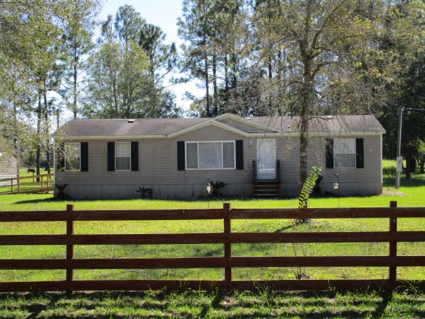
Building # 1
| Heated Sq Ft | Year Built | Value |
|---|---|---|
| 1404 | 2002 | $77,866 |
Structural Elements
Land Lines
Personal Property
None
TRIM Notices
Property Record Cards
Disclaimer
The Nassau County Property Appraiser's Office makes every effort to produce the most accurate information possible. No warranties, expressed or implied, are provided for the data herein, its use or interpretation. The information contained herein is for ad valorem tax assessment purposes only. The Property Appraiser exercises strict auditing procedures to ensure validity of any transaction received and posted by this office but cannot be responsible for errors or omissions in the information received from external sources. Due to the elapsed time between transactions in the marketplace, and the time that those transactions are received from the public and/or other jurisdictions, some transactions will not be reflected.